
Macomb Township ZIP Coverage
The township Recreation Plan identifies two ZIP codes serving all of Macomb Township. Its split is a delivery description, not a parcel-by-parcel jurisdiction map. ZIP 48044 covers most of the community south of 23 Mile and west of North Avenue. ZIP 48042 covers the remaining, more sparsely developed portions. Both appear as Macomb mailing ZIPs in official postal and Michigan map sources. Use the table as a starting point, then verify the complete street address with USPS before relying on a ZIP for any later record search.
| ZIP | Areas covered | Post office | Research note |
|---|---|---|---|
| 48042 | Remaining portions outside the plan's 48044 description; more sparsely developed areas | USPS Macomb delivery route; exact station name and address not located | Check the exact address. ZIP delivery geography is not the legal township boundary. |
| 48044 | Most township area south of 23 Mile and west of North Avenue | USPS Macomb delivery route; exact station name and address not located | Includes much of the denser south and west community. Check the address, not just the city label. |
No official ZIP realignment or split date was located. There is also no official address-level list of every place where a Macomb mailing ZIP and a township boundary diverge. The available evidence supports the two-area description above, not a precise legal boundary line.
Macomb Township ZIP 48044
For ZIP 48044, the local plan's useful geographic marker is south of 23 Mile and west of North Avenue. It covers most of the township under that description and much of the denser south and west area. A search that starts with only “Macomb, MI 48044” is still incomplete because the city and ZIP portion is a mailing clue. Enter the full street address in USPS, then use the address or parcel in the township property system to confirm the property geography.
The 23 Mile corridor has more than one historical name. East of the relevant division it is Romeo Plank or Whiskey, while west it is Coldwater. An older document may use an alias rather than a postal-friendly road form. Where road wording differs, the parcel number, subdivision lot, or legal description is more dependable than assuming the address text is identical.
Macomb Township ZIP 48042
ZIP 48042 covers the remaining parts of Macomb Township under the Recreation Plan's two-ZIP description and is associated with more sparsely developed areas. It also carries the Macomb mailing identity. That postal identity does not mean Macomb is an incorporated city boundary. Macomb Township is a charter township in Macomb County, and county-level records commonly resolve through Mount Clemens. Confirm a property relationship through the parcel record rather than treating a city label or ZIP alone as a jurisdiction result.
Use 48042 as a precise delivery refinement, then preserve the separate parcel and mailing fields from the property record. The assessor's situs field says where the parcel sits. An owner's mailing field says where tax notices go. Neither should be turned into a broad list of people connected to the ZIP. A Principal Residence Exemption item can add assessment context, but it is not conclusive proof of current occupancy.
Verify a Macomb Township ZIP
The USPS ZIP Code Lookup is the first stop for delivery verification. Its “Find by Address” route uses a street address, city, and state. Its city-and-state route returns all ZIPs for that locality. The first route is the stronger choice for a record search because it tests the full deliverable address. It does not establish township jurisdiction, ownership, registration, or a property boundary. Follow a postal result with the parcel record when the question concerns a specific Macomb Township address.
The USPS lookup interface shows the two verification routes used for address and city-state searches.
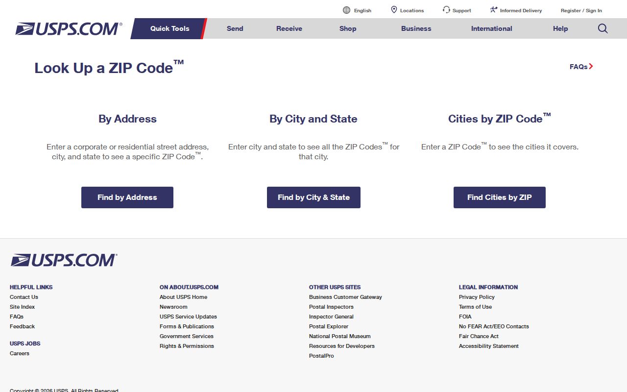
Use the postal result to standardize the delivery address before carrying the search into township or county records.
Search a Macomb Township ZIP
A ZIP is most effective as a check and refinement, not as a stand-alone people search. The public property system accepts an address, owner name, or parcel number. Its address route can find an address that includes a ZIP, but the inspected portal does not document a ZIP-wide parcel export. Michigan's voter portal uses ZIP with personal identity fields, not as a ZIP roster. The following order keeps the search within the capability each system actually documents.
- Verify the complete address in the USPS postal lookup and record the standardized delivery result.
- Search the address, owner, or parcel in Macomb Township BS&A Online Public Records to identify the situs, parcel, owner, legal description, and property context.
- When checking an individual registration, use Michigan Voter Information Center with first name, last name, birth month, birth year, and ZIP.
- For a lawful voter-file request, use the county or state form by jurisdiction, district, ward, or precinct as appropriate. Those documented scopes are not a ZIP-delivery boundary.
- Once the ZIP has narrowed the address, use the Macomb Township street directory for the parcel, map, and recorded-deed sequence.
Note: A USPS result verifies delivery geography; it does not replace a parcel record, recorded instrument, or individual voter confirmation.
Macomb Township ZIP Record Inputs
The input fields below show where ZIP fits into the official tools. The differences matter. USPS tests a delivery address. BS&A tests property-related fields. MVIC uses ZIP as one required part of an individual name search. The county and state voter-file forms use government jurisdiction or district selections instead of a general postal boundary. None of these source designs documents a simple public roster for either local ZIP.
| Source and field | Input type | Required | Documented ZIP role or limit |
|---|---|---|---|
| USPS Find by Address | Street address, city, state | Address route | Verifies the delivery ZIP for a full address |
| USPS city/state lookup | City and state | City-state route | Returns all ZIPs for the named locality, not a parcel boundary |
| BS&A Address | Text | No, selected mode | Can locate a ZIP-bearing address; no ZIP-wide parcel export is documented |
| BS&A Name or Parcel Number | Text | No, selected mode | Property routes, not ZIP filters |
| MVIC First/Last, Birth Month/Year, ZIP | Text, dropdown, number | Yes for name search | Five-digit ZIP refines an individual registration search |
| MVIC address route | Street, apartment or lot, city, state, ZIP | Address fields; apartment optional | Early-voting address lookup, not a ZIP-wide resident list |
For a public inspection or a request beyond the online display, Macomb Township Assessing lists public inspection, email, and phone channels. It estimates three to five business days for inquiries and three to seven business days for production; a Michigan FOIA request may be needed. County GIS can answer parcel-geography questions at 586-469-5285 or gis.questions@macombgov.org.
Macomb Township ZIP Boundaries
ZIP code boundaries are delivery geography. They are not census tracts, voting precincts, neighborhoods, township limits, or proof of residence. A Macomb mailing ZIP can appear beyond a legal township boundary, and a township parcel can carry a mailing city and ZIP combination that does not mirror municipal lines. The research did not locate an address-level mismatch inventory, so verify each full address with USPS and then test its parcel and jurisdiction through township or county sources.
- ZIP
- A Postal Service delivery code used to sort mail. It is not a legal municipal boundary.
- ZIP+4
- An added four-digit delivery refinement used with a ZIP. It narrows mail routing but does not change the underlying township jurisdiction.
- PO-box ZIP
- A ZIP used for post-office boxes. The local research did not identify a PO-box-only ZIP for Macomb Township.
- Unique ZIP
- A ZIP assigned to a single organization or delivery arrangement. No Macomb Township unique ZIP was identified in the inspected sources.
- Carrier route
- A mail-delivery route inside postal operations. It is not a resident roll or property boundary.
Macomb Township ZIP Road Aliases
Road aliases matter even in a ZIP search. The township's mile-road names include M-59, Hall, and Rosso for 20 Mile; Shoemaker for 21 Mile; Waldenburg for 22 Mile; Romeo Plank, Whiskey, and Coldwater around 23 Mile; French for 24 Mile; Arnold for 25 Mile; and Marine City Highway for 26 Mile. USPS verification should use the current deliverable form. A historical deed, directory, or newspaper may require the older form as a second search.
When the road text conflicts, keep the parcel number and legal description in the search notes. The legal description can remain stable even if the street name changes, and BS&A accepts a parcel-number search. Township maps, county GIS, subdivision plats, and recorded instruments then provide the needed geographic cross-check.
Macomb Township Postal History
Historical address research should not force today's ZIP codes onto older records. Directories, Sanborn maps, census schedules, deeds, and legal descriptions often predate modern postal use or use road aliases. The Mount Clemens City Directory Master Index has a published 1896 to 1966 span, while the Farm Journal Rural Directory of Macomb County has identified 1916 to 1921 runs. These resources can put an occupant, business, or property context at an address in a publication year, but coverage and jurisdiction vary.
For a past address, search the road alias and modern form, check whether the entry falls in the township or city-centered directory context, then compare the legal description and deed trail. The goal is to align the record's own time and geography with the parcel, not to retrofit a present delivery code onto an earlier source.
Macomb Township ZIP Limits
A Macomb Township ZIP code directory cannot turn a postal code into a complete person or household record. The property portal is an ownership and assessment source. The individual voter tool withholds protected fields and does not display ballot choices. County and state voter-file requests follow named legal scopes and fees. GIS shows parcel and public-layer context. These records must be used for personal, lawful research without trying to expose protected voters, confidential-address participants, driver data, or private account information.
When a result is uncertain, ask the record custodian for the relevant geographic or access rule rather than assuming the postal label decides it. The two documented local ZIPs, 48042 and 48044, are the starting point. The full address, parcel, legal description, and jurisdiction provide the needed confirmation.